Local Coastal Program
Project Status: Ongoing
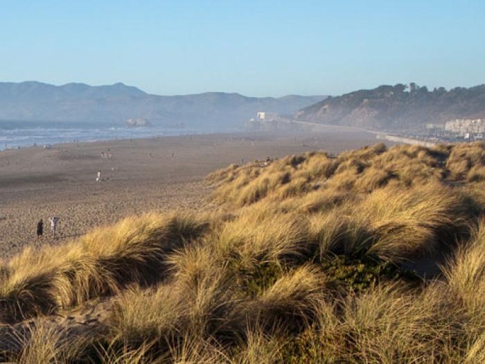
The Local Coastal Program (LCP) is a policy and regulatory document required by the California Coastal Act that establishes land use, development, natural resource protection, coastal access, and public recreation policies for San Francisco's Coastal Zone. The Coastal Zone extends approximately 6 miles along the City’s western shoreline, from the Point Lobos recreational area in the north to the Fort Funston cliff area in the south.
San Francisco's LCP was originally certified in 1986. The policies of the LCP were reflected in the Western Shoreline Area Plan (WSAP), the element of the General Plan that establishes land use, development, and environmental policies for this area.
The LCP consists of two components: (1) the Implementation Plan and (2) the Land Use Plan. The former is comprised of Planning Code provisions that relate to development within the Coastal Zone that have been certified by the California Coastal Commission (CCC). The latter consists of those portions of the WSAP that have been certified by the CCC. While thematically consistent, neither the Implementation Plan nor the Land Use Plan are identical to the current Planning Code or General Plan.
In early 2024, the City and CCC began a partnership to identify opportunities to update and align San Francisco's LCP to better reflect the shared contemporary goals of our two agencies. This page will be updated as that work continues.
Coastal Zone Map
The south end of the Coastal Zone includes the Lake Merced area, the Zoo, the Olympic Club, and the seashore and bluff area of Fort Funston. The Coastal Zone spans the Ocean Beach shoreline and includes Golden Gate Park west of Fortieth Avenue, the Great Highway/Sunset Dunes corridor and the adjacent residential blocks in the Sunset and Richmond districts. The north end of the seashore includes the Cliff House and Sutro Baths area, Sutro Heights Park, and Point Lobos recreational area.

Documents
The following documents relate to the City’s LCP and related studies, programs, and projects.
Regulatory and Policy Documents
- Certified Local Coastal Program: Land Use Plan
- Certified Local Coastal Program: Implementation Plan
- Western Shoreline Area Plan
- Planning Code Section 330
Background Documents
- Planning Commission packet for coastal hazard-related amendments to the WSAP and LCP (Fall 2017)
- Coastal Protection Measures and Management Strategy for South Ocean Beach (2015)
- Ocean Beach Master Plan (2012)
- Public Works Plan for San Francisco Wastewater Management Program (1979)
- Interim Ocean Beach Shoreline Protection Coastal Development Permit (2015)
- Draft San Francisco Littoral Cell Coastal Regional Sediment Management Plan (2016)
- Sea Level Rise Action Plan (2016)
- Sea Level Rise Existing Data and Analyses Technical Memorandum (2016)
- Ocean Beach Climate Change Adaptation Project (SFPUC) (2023)
Application Packet
Please direct questions unrelated to permits to:
Amnon Ben-Pazi
Senior Planner
amnon.ben-pazi@sfgov.org
628.652.7428