Transportation Network Companies and Land Use Planning
Project Status: Completed
San Francisco Planning led a study to research and analyze the impact of Transportation Network Companies (TNCs, like Lyft and Uber) on land use planning and identify policy options to address the impacts. A TNC and Land Use Planning study was published in June 2022.
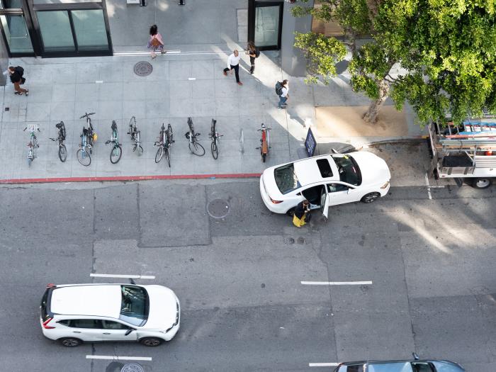
The use of ridehailing (also known as ridesourcing) services offered by transportation network companies (TNCs, like Lyft and Uber) has grown substantially in recent years in San Francisco and other cities around the world. These companies provide a direct and convenient mode of transportation that is similar to an individual driving their own private car but without the associated costs of private vehicle ownership or parking inconveniences. Researchers have studied TNCs’ effects on individuals’ travel behavior and congestion. For example, the San Francisco County Transportation Authority (Transportation Authority) estimated TNC trips to be about 15% of vehicle trips within San Francisco in 2016.1
Given the relationship between land use and transportation, the Planning Department led a study to research and analyze the impact of TNCs on land use planning and identify policy options to address the impacts. The study team examined the following questions:
- Are some land uses and densities associated with more TNC activity* than others?
- What other built environment features are associated with TNC activity?
- Do TNCs create new or alter existing land uses?
- How is the development community reacting to TNCs?
* For study purposes, “TNC activity” refers to pick-ups and drop-offs made by ridehail vehicles.
Study findings showed that certain land uses and densities are associated with more TNC activity than others. These include visitor, retail, residential, and cultural, institutional, and educational uses. The most dense areas of San Francisco were also positively associated with TNC activity, such as the northeastern parts of the city. Study findings also demonstrated that high daily parking costs and not having access to a car are positively associated with TNC activity (i.e., is an indicator of more pick-ups and drop-offs by TNCs). Read about all the findings in our paper.
The findings from this study will inform updates to the General Plan, including the Transportation Element, which is anticipated to be presented to the Planning Commission for consideration in 2024. The Planning Department will also kick off a process this fall to develop new Planning Code controls for emerging mobility. The process will engage stakeholders in the development of the definitions for these land uses and controls such as preferred locations, and the types of associated controls such as site design and intensity.
The Planning Department does not expect TNC impacts and issues to go away. In fact, ridehail activity is rising, as shown in the significant rise of taxes collected for TNC rides in July and August 2021 compared to the prior 2020-2021 fiscal year.1
Other reports from City agencies indicate that TNC usage and growth models may move San Francisco away from its Transit First policy and its goals for climate action and racial and social equity.2 The City should set the policy foundation for TNCs and other emerging mobility providers to respond to its principles and rules instead of the other way around. It must be the City, through its residents, community representatives, and elected representatives who manages the City’s public streets. The Planning Department, specifically, needs to work with stakeholders to affect land use planning policy locally via the policy options presented in the study, and to influence various regulations at other levels.
1 San Francisco County Transportation Authority. (2021). Executive Director’s Report. https://www.sfcta.org/sites/default/files/2021-09/EDR%2009.28.21FINAL.pdf
2 See San Francisco County Transportation Authority. (2018). TNCs and Congestion. https://www.sfcta.org/sites/default/files/ content/Planning/TNCs/TNCs_Congestion_Report_181015_Final.pdf
Also see San Francisco Municipal Transportation Agency. (2019). TNCs and Disabled Access:
https://www.sfmta.com/sites/default/files/reports-and-documents/2019/09/transportation_network_companies_tncs_and_disabled_access_report-072019.pdf
Reports
TNC and Land Use Planning Study, June 2022
The Planning Department is often involved in discussions with the community and appointed and elected officials about the impacts of San Francisco’s growth, including transportation. In recent years, discussions include the amount of TNC activity associated with a proposed land use, such as a grocery store, office, or housing, and how developers should respond to anticipated TNC activity (e.g., loading, parking). These discussions informed the study’s questions.
For the study, the Planning Department collected qualitative data through focus groups with TNC drivers, targeted online surveys for TNC drivers, review of land-use permit applications submitted to the Planning Department, and individual phone interviews with developers.
Listen to the project team’s presentation about the study at the Planning Commission hearing on June 30, 2022: