Balboa Park Station Area Plan
Project Status: Completed
The Balboa Park Station Area Plan was adopted in May 2009 into the General Plan.
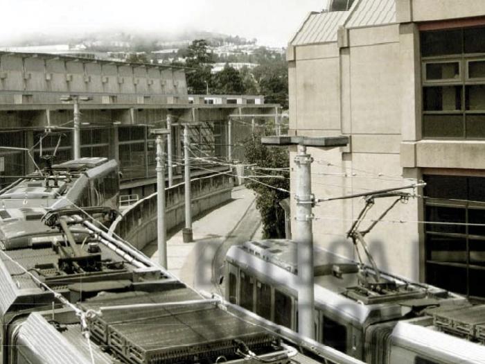
The area is strongly served by public transportation and contains a diverse range of uses.
The Balboa Park Station Area has a good urban framework. The area is strongly served by public transportation and contains a diverse range of uses. Over the latter half of the 20th Century, the area experienced a decline in vitality and vibrancy and as result, in the quality of life for the people who live there.
The Plan’s objectives and policies are informed by three key principles;
- Improve the area’s public realm,
- Make the transit experience safer and more enjoyable, and
- Improve the economic vitality of the Ocean Avenue Neighborhood Commercial District.
The Area Plan includes the Ocean Avenue Neighborhood Commercial District and related zoning controls to ensure that new development meets the goals outlined in the Plan. The Area Plan also includes a Community Improvements Program. The Community Improvements Program identifies the projects described in the Area Plan and proposes a strategy to get them built.
Final adopted Area Plan and Planning Code amendments
Environmental Impact Report (2004.1059E)
Other Resources
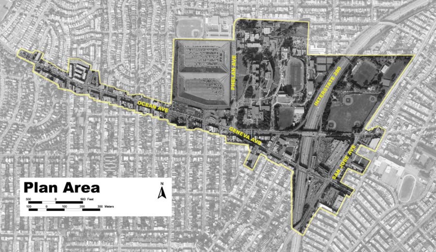
Balboa Park Station Area Plan is in south central San Francisco. The area comprises approximately 210 acres and includes the Ocean Avenue Campus of City College of San Francisco (CCSF), the Ocean Avenue Neighborhood Commercial District, Balboa Park, and the Balboa Park BART station. More specifically, the plan area consists primarily of those parcels fronting on Ocean, Geneva and San Jose Avenues. The area provides a diverse range of uses including; institutional, recreational, retail, housing, and transportation.
Th e plan area is best characterized by four distinct areas; the Transit Station Neighborhood, City College of San Francisco, the Reservoir, and the Ocean Avenue Commercial District.
- The Transit Station Neighborhood refers to the area immediately surrounding the Balboa Park Station. It is bounded by Interstate 280 to the west and residential neighborhoods on all other sides.
- Ocean Avenue Campus of the City College of San Francisco is on the north side of Ocean Avenue, east of the Ocean Avenue Neighborhood Commercial District. CCSF is bounded by Ocean Avenue to the south, I-280 to the east, residential neighborhoods to the north, and the Balboa Reservoir to the west. The campus occupies 67.4 acres and includes academic and support buildings, commons, open spaces, walkways and roads, and parking facilities. The Ocean Avenue Campus is the historical heart of the CCSF system and continues to serve as its flagship campus, serving the majority of its students.
- Balboa Reservoir is located on the west side of Phelan Avenue. It is bounded by Riordan High School and the Westwood Park residential neighborhoods to the north, and the Ocean Avenue Neighborhood Commercial District to the south. The reservoir is divided into two basins. The San Francisco Public Utilities Commission (SFPUC) owns the north basin, while CCSF owns the south basin.
- The Ocean Avenue Neighborhood Commercial District extends east-west along Ocean Avenue from Phelan Avenue to Manor Drive.
The Plan provides a vision to connect, restore, and enhance the area. This vision is now being carried out through individual projects:
Balboa Reservoir Study
The Planning Department, the Office of Economic and Workforce Development, (OEWD) and the Public Utilities Commission (PUC) are working with community members to create principles for developing housing on the Balboa Reservoir site, with a significant amount of affordable housing and open space for the neighborhood. For more information, please view the Planning Department’s Balboa Reservoir Study web pages.
Ocean Avenue Corridor Design
The Planning Department has identified near-term streetscape improvements for Ocean Avenue, and long-term streetscape and safety improvements on Ocean and Geneva east of Phelan Avenue. For more information, please view the Ocean Avenue Corridor Design web page.
BART Westside Walkway Balboa Park Bart Station
A new station entrance and safe, accessible walkway connecting Balboa Park BART Station with Ocean Avenue was completed in 2011. This eliminated the need for BART and MUNI patrons to walk along the unsafe tracks and narrow pathway through the adjacent SF MUNI yard. Several additional Balboa Park Station improvements to pedestrian safety and access improvements are currently underway.
Balboa Park Bicycle and Pedestrian Connection Study
Short-term pedestrian improvements identified by the SFMTA in the Balboa Park Station Bicycle and Pedestrian Connection Study have been constructed. These include a new signal-protected pedestrian crossing on Ocean Avenue, and new bike lanes on Phelan Avenue between Ocean and Judson Avenues. For more information please view the 2015 Annual Report of the Interagency Plan Implementation Committee.
Balboa Park Improvement Plan
The Trust for Public Land and the San Francisco Department of Recreation and Parks partnered to build improvements to Balboa Park, including a new playground, skate park and public art. For more information please view the Trust for Public Land’s Balboa Park web page.
The Restoration of the Geneva Car Barn and Power House
The local community and the Recreation and Parks Department are working to rehabilitate the Geneva Car Barn and Power House. For details, see the description at the bottom of this page or the Department of Recreation and Parks’ website for the project.
The Reconfiguration of the Phelan Loop
The City College bus terminal, located at Ocean and Phelan Avenues, was reconfigured in 2013. This improved the bus turnaround and pedestrian connections, created a new public plaza, and facilitated the construction of affordable housing.For more information, see the SFMTA’s press release about the completion of the Phelan Loop.