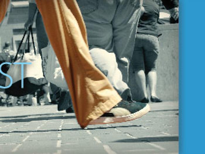
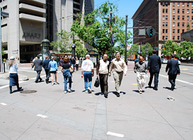
WalkFirst
A framework for pedestrian improvements in San Francisco.
SFMTA is now the lead agency for this effort. Learn more at SFMTA.
WalkFirst Phase 1 - Framework
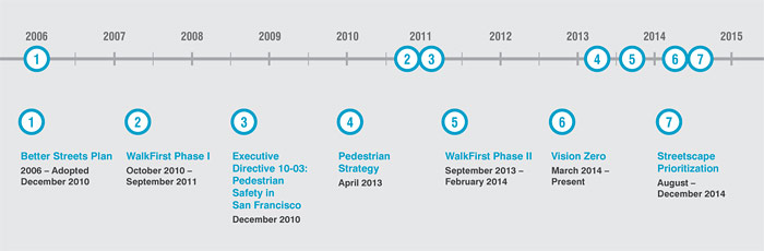
In 2010, the City received a grant from the California Office of Traffic Safety to fund the first phase of WalkFirst, a project to develop a framework for how the City would prioritize future pedestrian improvements. This framework included a map of Key Walking Streets (streets where people are walking) and a map of Pedestrian High Injury Corridors (streets with the highest concentration of severe and fatal injuries) were developed.
WalkFirst Phase 2 - Pedestrian Safety Prioritization
WalkFirst Phase 2, initiated in September 2013 took a data driven approach to prioritize pedestrian safety improvements on the Pedestrian High Injury Network develop as part of Phase 1. The City looked at pedestrian injury statistics and crash profiles to identify locations where safety improvements are most needed. A variety of criteria were then used to prioritize pedestrian safety projects and programs on the High Injury network. A capital project list was published in February 2013.
This work continues and is being implemented as part of Vision Zero. Vision Zero is a citywide commitment to reduce all traffic fatalities to zero. The Vision Zero Task Force meets quarterly and is chaired by the San Francisco Municipal Transportation Agency and Department of Public Health.
WalkFirst Phase 3 - Streetscape Prioritization
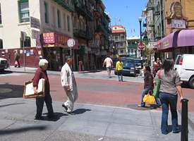
WalkFirst Phase 3 is the remaining piece. Similar to what was done in WalkFirst Phase 2, WalkFirst Phase 3 starts with the Streetscape Network identified in Phase 1 (formally called the Key Walking Streets) and uses a data-driven process to identify and prioritize corridors for future streetscape improvements. Streetscape streets represent places where people are walking OR would walk if the conditions were better. The factors used to identify these streets include population density, transit ridership, land use, and priority pedestrian streets identified in streetscape plans. To view the specific criteria, click here.
Timeline
Phase 1
October 1, 2010 - September 30, 2011. In 2010, San Francisco received a grant from the California Office of Traffic Safety to fund the first phase of WalkFirst, a project to develop a framework for how the City would prioritize future pedestrian improvements. A map of Key Walking Streets (streets where people are walking) and a map of Pedestrian High Injury Corridors (streets with the highest concentration of severe and fatal injuries) were developed.
| Document | Date |
|---|---|
| WalkFirst: Improving Safety & Walking Conditions in San Francisco | Oct. 2011 |
| WalkFirst: Appendix | Oct. 2011 |
Background Documents and Maps
| Document | Date |
|---|---|
| WalkFirst Fact Sheet | |
| WalkFirst Press Release | Mar. 29, 2011 |
| Determining Pedestrian Activity Locations | |
| Maps of Pedestrian Activity Locations | |
| Pedestrian Injury Maps (by Neighborhood) | |
| Existing Conditions Basemaps The Existing Conditions Base Maps illustrate factors that contribute to where people walk. These pedestrian activity factors will help us figure out where people currently walk in the city (where there are high levels of pedestrian activity), and where they would be likely to walk where good pedestrian conditions exist. These maps will be used to help us develop a map of key walking streets in San Francisco, and identify which streets or areas should be included on this map. When combined with data about pedestrian safety and physical street conditions, the map of key walking streets will help us to prioritize pedestrian improvements in the city. The maps are organized by category: Access/Need to Walk; Transit Ridership; Density of People; Pedestrian Generators; Demographics; Street Slope; Income | |
| Rethinking the Streets Space: What's Next? PlanNetizen Article | Jul. 21, 2011 |
Presentations to the Pedestrian Safety Advisory Committee (PSAC)
| Document | Date |
|---|---|
| Prioritizing Walking Improvements | Nov. 8, 2011 |
| Prioritizing Walking Improvements | Oct. 11, 2011 |
| Prioritizing Walking Improvements | Sep. 13, 2011 |
| Prioritizing Walking Improvements | Aug. 9, 2011 |
| Prioritizing Walking Improvements | Jun. 14, 2011 |
| Prioritizing Walking Improvements presentation to Pedestrian Safety Task Force | Jun. 14, 2011 |
| Prioritizing Walking Improvements | May 10, 2011 |
| Pedestrian Activity & Safety | Apr. 12 , 2011 |
| Pedestrian Activity Criteria Presentation | Mar. 8, 2011 |
| Existing Pedestrian Conditions Presentation | Feb. 8, 2011 |
Phase 2
WalkFirst is a data-driven process to prioritize 5 years of capital improvements to meet Pedestrian Strategy goals and make San Francisco a safer place to walk. This work builds on the WalkFirst Phase 1 completed in September 2011.
On March 6, 2014, Mayor Lee joined City partners including the SFMTA, Planning Department, Department of Public Health, Department of Public Works and the Controller's Office in presenting the recommendations of WalkFirst, a first-of-its-kind initiative in the United States to improve pedestrian safety in San Francisco. Tasked with creating a strategic framework to identify and deliver pedestrian projects and programs in San Francisco, WalkFirst has combined public engagement with technical and statistical analysis of where and why pedestrian collisions occur on our city streets, and updated knowledge about the effectiveness and costs of various engineering measures proven to reduce pedestrian collisions. As a result, WalkFirst has now provided the City with a roadmap of urgently needed pedestrian safety projects and programs over the next five years and the toolbox of measures that can be leveraged to reduce serious pedestrian injuries and fatalities. The City is now ready to leverage $17 million to improve pedestrian safety at 170 high-priority locations identified by WalkFirst over the next five years. The Mayor's Transportation Task Force recommends that up to $50 million be available for this program. WalkFirst is part of the City's larger Vision Zero program, a goal to eliminate serious pedestrian injuries and fatalities in the City in the next 10 years.
- Download the Briefing Book
- Download the Frequently Asked Questions
- Download the list of Vision Zero Projects
- Learn more about Vision Zero
Phase 2 Steps / Time Frame
| Date | |
|---|---|
| Public Outreach & Engagement | November/January 2013 |
| Technical Analysis | November/December 2013 |
| Pedestrian Safety Improvements Drafted | January 2014 |
| SFMTA Adopts List of Improvements | February 2014 |
| Funding for Pedestrian Safety Improvements | July 2014 |
Phase 3
San Francisco's streets represent 25% of city land. Streets are our most important public resource, in large part because they are shared equally by all residents of San Francisco. Our streets are not just about transportation, but also recreation, social and economic activity, and ecological performance. The way in which we design our streets can help support these activities.
Over the years our streets have been transformed through efforts such as the Great Streets Project and the 2011 Road Repaving and Street Safety Bond, using the Better Streets Plan as a guide. These projects enhance the public realm, improve the transportation function of the street, and create other economic, environmental and social benefits.
Streetscape Projects
Streetscape projects improve the street environment for all people by providing space for mobility, social and recreational activities. Streetscape projects enhance the aesthetic and ecological qualities of the street, improve safety, and enrich the street's character and identity. Streetscape projects could include improvements such as sidewalk extensions, street trees, sidewalk landscaping, green infrastructure, street furniture, pocket parks, and other amenities.
The specific project elements will depend on a number of factors including the project budget, existing conditions of the street and community feedback. Below is a table which outlines the types of improvements you might see, depending on the specifics of the project.
Very Light Complete Street Enhancements
Description: Includes a mix of pedestrian and bike enhancements and greening elements, but would potentially not include full list of enhancements desired by the community (e.g. separated bike lanes, sidewalk widening)
Potential Scope of Work: Infill street tree planting (there are already many healthy trees on the corridor), bike lane striping, median planting, and upgrades to existing street lights.
Examples: Lower Polk, Van Ness Avenue, San Bruno Avenue, 19th Avenue Median (see image above) and Point Lobos.
Cost Per Block: $100k - $500k
Light Complete Street Enhancements
Description: Includes a mix of pedestrian and bike enhancements and greening elements, but would potentially not include the full list of enhancements desired by the community (e.g. separated bike lanes, sidewalk widening). NOTE: To date, most complete streets delivered by the city have cost more than $1M block or did not include repaving.
Potential Scope of Work: Repaving, infill street tree planting (there are already many healthy trees on the corridor), a limited number of bus bulbouts, ADA improvements, bike lane striping, median reconstruction, and upgrades to existing streetlights. Alternatively, this could be complete streets with short blocks such as Leland Avenue and Broadway Street.
Examples: Folsom Streetscape (19th to Cesar Chavez) and the Divisadero Streetscape (see image above)
Cost Per Block: $500k - $1.2M
Full Complete Street Enhancements
Description: Includes substantial street and sidewalk enhancements that result in a more thematic appearance of the corridor.
Potential Scope of Work: Substantial pedestrian and bike improvements (such as sidewalk widening and separated bike lanes), street greening, street lighting, transit station upgrades, and reconfigured traffic patterns.
Examples: Valencia Streetscape (see image above) and the planned Jefferson, Masonic, 2nd Street Streetscape projects.
Cost Per Block: $1.2M - $2.5M
Purpose & Outcomes
The goal of WalkFirst Phase 3 was to identify where the City should make streetscape improvements to have the greatest benefit, given limited funding. The project first identified a citywide Streetscape Network, representing places where people are walking OR would walk if the conditions were better. The factors used to define these streets include population density, transit ridership, land use, and priority pedestrian streets identified in streetscape plans. To view the specific criteria, click here.
The Streetscape Network was further distilled to a number of Priority Project Locations, segments of the network with high pedestrian activity, poor pedestrian environment and neighborhood commercial-type uses. Funding for streetscape improvements will be prioritized at these locations.
Final Report
This final report documents the methodology used to prioritize locations for future streetscape improvements.
- Final report
- Appendix A1 - Best Practices Report
- Appendix A2 - Prior Plan Methodology
- Appendix A3 - Scenario Planning Technical Memorandum
- Appendix A4 - Database of Streetscape Variables
- Appendix A5- Streetscape Suitability Coordination
Links & Resources
Project Team & Staff Contacts
This project is a partnership among many City agencies, including the San Francisco Municipal Transportation Agency, SF Planning Department, Department of Public Health, San Francisco Public Works, Mayor's Office, Public Utilities Commission and the Controller’s Office.
For more information, contact:
Lily Langlois, Planning Department
lily.langlois@sfgov.org
Chava Kronenberg, SFMTA
Chava.Kronenberg@sfmta.com